Historic Ipswich - Bramford Road Redevelopments (far east)
The exact year that changes started at the far eastern end of Bramford Road is unknown, and I would appreciate that if you have any information about the timeframe, or anything else, that you email me at ipswichhistoric@gmail.com
What we are reffering to by "far east" Bramford Road, is the qrea between Norwich Road and Chevallier Street.
90 Bramford Road
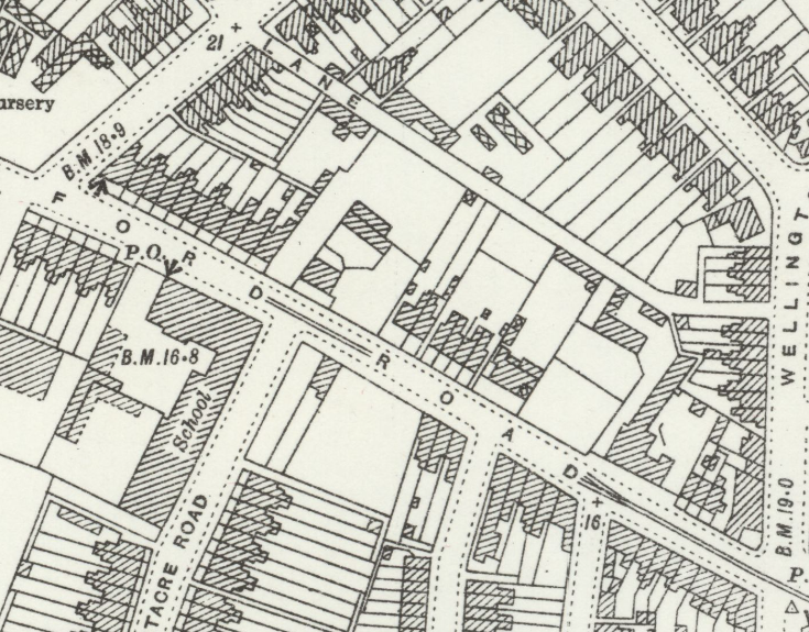
OS Map Revised 1924 to 1925, Published 1927
During an unknown period of time, 90 Bramford Road was a lorry depot, which went against planning regulations as the land was allocated for residential use. Evidence of this is on a planning application made in 1954 that simply said "Installation of petrol pump." The application was refused, and in the decision notice, it shows the following:
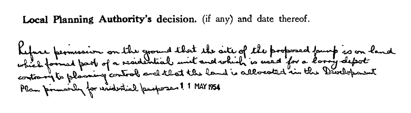
"Refuse permission on the ground that the site of the proposed pump is on land which formed part of a residential unit and which is used for a lorry depot contrary to planning control and that the land is allocated in the Development Plan primarily for residential purpose"
Later planning applications show that an underground petrol tank was approved (1954), and the site was a builder's yard, shown in an application for two W.C's and offices (1965). These applications show that the allocation of the land likely have changed from residential.
Here's a short timeline of the following approved planning applications
- 1966 - Stores,offices and showroom.
- 1968 - Various advertisements.
- 1968 - Internally illuminated forecourt sign and resiting of non illuminated sign.
- 1978 - Change of use from builders yard to storage of building and office cleaning equipment in yard and ancillary office connected with business of office cleaners.
- 1985 - Change of use from storage yard (connedcted with office cleaners) to heating and pluming contractors depot.
- 1991 - Increase height of west wing.
- 1994 - Internally illuminated pole sign.
- 1996 - Construction of two jetwash machines and screen fencing.
- 2002 - Erection of single storey class A1 shop and three storey block of 14 flats, construction of access and car park and residential buildings/structures
- 2003 - Externally illuminated fascia signs.
The planning application from 2002 approves the construction of Abbey Court ("three storey block of 14 flats") and Farmfoods ("single storey class A1 shop").
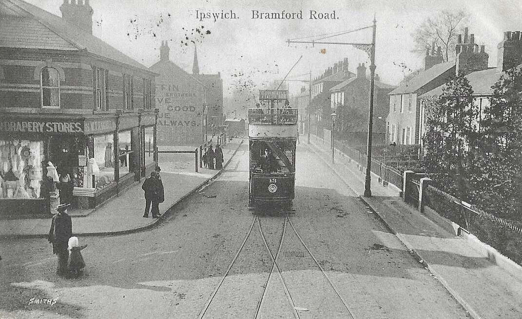
1905 image
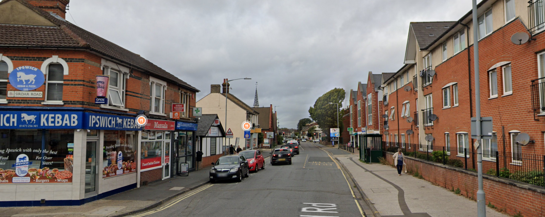
2023 image